Met Office: Amber warning for snow and ice issued for Flintshire this weekend
Flintshire residents are being urged to prepare for severe weather this weekend, as the Met Office issues an amber warning for snow and ice across the area.
The warning, in effect from 6 pm on Saturday until midday on Sunday, predicts significant snowfall and freezing rain, likely to cause major disruption to transport and services.
Snowfall of 3-7cm is expected in lower-lying areas, with accumulations of up to 15-30cm possible on higher ground.

Met Office Chief Forecaster Jason Kelly said: “This weekend will bring a range of weather hazards to the UK, notable snow accumulations, freezing rain, ice and heavy rain as well as some gusty conditions.
“We have issued a number of severe weather warnings, including Amber warnings for snow and ice in parts of England and Wales. Some significant accumulations of snow are possible across parts of Wales, the Midlands and northern England in particular.”
Freezing Rain Hazard
As milder air moves northwards, snow could turn into freezing rain in some areas, particularly in Wales and the Midlands, creating a significant risk of ice. Freezing rain occurs when rain droplets freeze instantly on contact with cold surfaces, forming a hazardous glaze of ice.
“There is a risk of freezing rain across parts of the Midlands and northern England, but especially Wales,” said Mr Kelly. “This could lead to some treacherous conditions in places.”
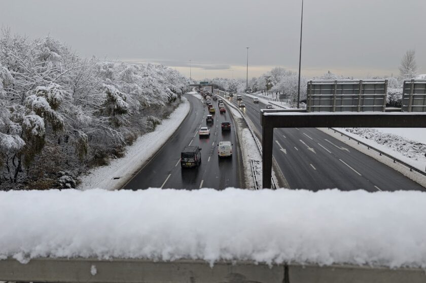
The National Highways Severe Weather Resilience Manager, Darren Clark, urged motorists to drive cautiously. “If you are travelling this weekend, keep your distance and reduce your speed. Gritters will be out treating our roads around the clock when ice or snow is forecast, but it is still important to drive to the conditions,” he said.
Drivers are also encouraged to prepare for winter conditions by packing essentials such as blankets, food, water, and a shovel.
Risk of Flooding
As milder air arrives later on Sunday, a rapid thaw of lying snow could increase the risk of flooding, especially in already saturated areas. Authorities have urged residents to monitor updates from the Environment Agency, Natural Resources Wales (NRW), and other relevant organisations.
Looking Ahead
While milder conditions are expected to briefly return, colder air is forecast to move in again early next week. Deputy Chief Forecaster Dan Holley said: “The system bringing this weekend’s snow will move away to the east by Monday, allowing a cold northerly flow to become established again for much of next week.
“Temperatures will remain below average, with widespread frost and the risk of ice at times. Some areas, especially in the north, may struggle to get above freezing for several days.”
The Met Office advises the public to stay updated via their website, social media channels, and mobile app, as further warnings may be issued.
Spotted something? Got a story? Send a Facebook Message | A direct message on Twitter | Email: [email protected] Latest News