Flintshire Forecast: Rising temperatures and Yellow warning for thunderstorms
There will be a shift in weather patterns locally as high temperatures and potential thunderstorms are forecasted for the weekend.
This comes as a warm plume of air from the south is set to influence the local weather, leading to a dramatic change in conditions.
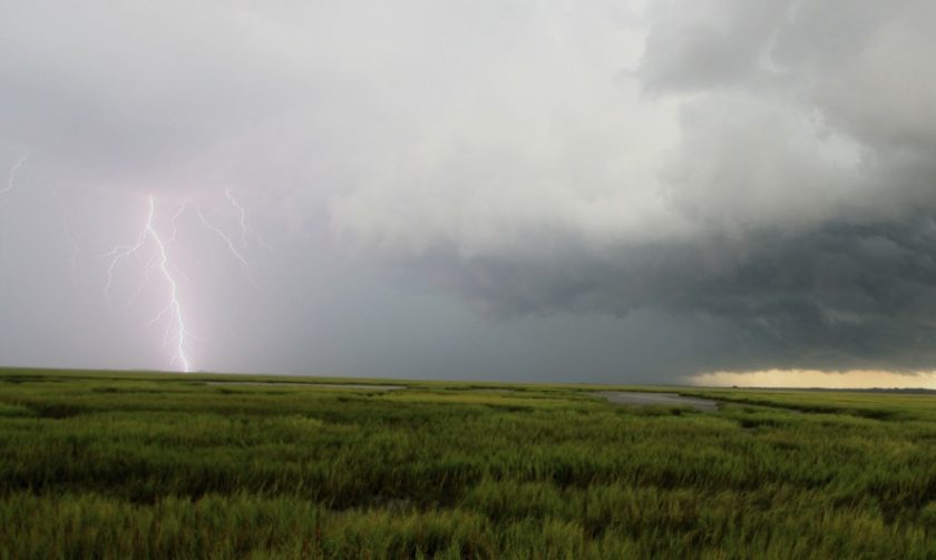
The Met Office has issued as Yellow Weather Alert for thunderstorms in Flintshire, across Wales and large parts of England.
The transition is expected to begin late on Friday, with the warm southern air increasing the chances of thundery showers.
As the weekend progresses, the risk of these thundery outbreaks is set to increase, with the possibility of heavy rain, hail, and strong winds in some places.
Temperatures are forecasted to rise later this week and into the weekend, with the warm air plume potentially causing temperatures to peak around 26°C in some parts of Flintshire. Night-time temperatures are also expected to remain well above average.
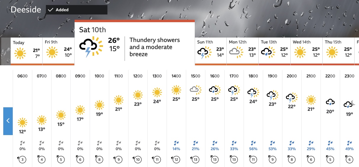
This rise in temperatures is coupled with an increased likelihood of potentially heavy and thundery showers, which could cause some localised disruption from as early as Saturday.
The Met Office warning states: “High temperatures developing across parts of England and Wales on Saturday are expected to trigger a scattering of showers across this area, some of which are likely to be torrential and thundery, bringing 30-40mm in an hour.”
“The odd place affected by multiple showers could see more than this, perhaps in excess of 60mm. As well as rain, hail, strong gusts of wind, and lightning will be additional hazards. Despite all of this, many places in the warning area will remain dry, or only see small amounts of rain, due to the well scattered nature of the heaviest showers.”
Interestingly, Storm Oscar, named by the Spanish Meteorological Service (AEMET), will not directly impact Flintshire. However, it will play a role in driving the warm plume of air into southern areas, contributing to the expected weather changes.
Met Office Deputy Chief Meteorologist Dan Harris said: “Although a plume of warm air will bring temperatures up to around 30°C in some parts of England, it brings with it the risk of some impactful thunderstorms. The general focus area for Saturday has become better defined over the past 24 hours, which has resulted in sufficient confidence to issue a “Very Low Likelihood” Yellow Thunderstorm Warning.
“While not everyone in the warning area will see the heaviest showers, or even showers at all, some are likely to be torrential and thundery, with 30-40mm falling in an hour. Some spots affected by multiple showers could see in excess of 60mm within the warning period. It’s worth noting that this far from the event the main focus area could change as latest forecast information becomes available, so it’s important to stay up to date with the latest forecast.
“It’s also important to note that this warmer air will also see relatively high night-time temperatures, often staying in the mid-teens Celsius for some.”
Spotted something? Got a story? Send a Facebook Message | A direct message on Twitter | Email: [email protected] Latest News