Deeside white out – as seen from space!
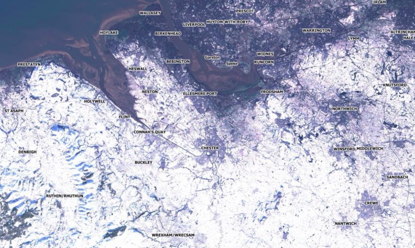
Earlier this morning a satellite passed over Flintshire and took a snap shot of the total snow cover in the area.
The satellite images were taken between 11:25am and 11:35am this morning by the European Space Agency’s Sentinel-2A observation satellite, one of a pair of identical craft built by Airbus, in a “sun chasing” moving orbit 500 miles above the Earth every 100 minutes and 40 seconds.
They are part of the ESA’s Copernicus mission, with more detail here on the ESA site.
The satellite captured the below image of the snow, to view the full size
John Murray, a Researcher in the Geographic Data Science Lab at University of Liverpool extracted the shots and processed them using the ESA’s free SNAP Software toolset.
The extent of #uksnow coverage mapped in North East Wales, Cheshire & Merseyside in this image taken by @CopernicusEU #Sentinel2A satellite this morning (RGB and near infrared) #opendata pic.twitter.com/oNzisyaPrs
— John Murray (@MurrayData) December 11, 2017
John explained to us that the data is captured in 12 different spectral frequency bands including visible red/green/blue and non-visible bands including infrared.
Usually the non-visible frequencies are used to monitor vegetation, atmospheric conditions and other environmental metrics.
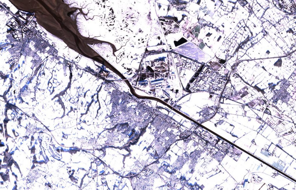
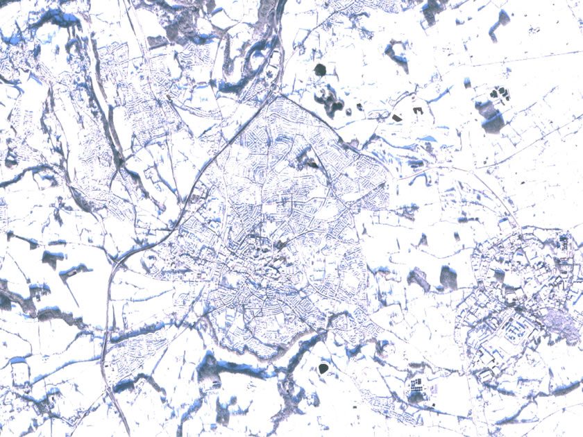
A second image shows Wrexham from above: 2meg image can be seen by clicking here.
John gave a brief overview of the orbit cycle of each satellite, telling us it is 143 slightly shifted paths, to cover the entire planet in both directions which takes a full 10 days to complete.
During that time it will pass over Deeside twice, so together with sibling Sentinel-2B the town is scanned 4 times in in every 10 day period.
Today’s orbit pattern (29 to 43 of the cycle) took the craft directly over Wrexham as you can see below, perfectly timed to snap our cold spell!

Thanks to Wrexham.com for the article..
Spotted something? Got a story? Send a Facebook Message | A direct message on Twitter | Email: [email protected] Latest News